
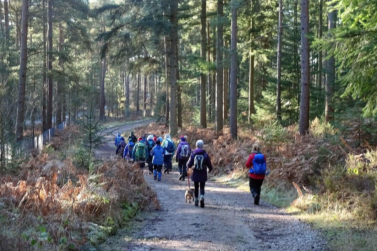

This moderately easy walk follows clear paths and tracks through pastures and woodlands.
It goes through Whinfell Forest, home of Center Parcs Holiday Village, descends to the wetland habitat of Cliburn Moss and follows the river Leith to make an impressive entry back into the village

start point qr-code (1)
1. From the crossroads walk 250 yards towards Appleby then turn left onto the signed footpath beside Howgate House. Follow the track, continuing as a field path beside a hedge and wall on the left. Great views appear of the fells to the north. On meeting a track turn left. After about 600 yards turn left and go through the second pair of wide gates onto a farm track. Walk beside a hedge on the left towards the forest. After the next gateway the path goes right then left beside a wall and fence on the right.
2. Go over a fence stile into the forest and keep ahead at a path crossing. Turn right onto the road. After two-thirds of a mile, where the road dips slightly down, turn left onto the path signed Whinfell Forest. Pass the bus stop and then cross the road near the Center Parcs entrance and continue along the forest track to the right of the holiday village fence. Whinfell Forest Center Parcs is a 400-acre resort with self-catering lodges, a sub-tropical pool area, spa, lake, sports plaza, outdoor adventures and playgrounds. After half a mile, where the track ahead is signed Private, turn left onto the signed footpath. Cross several fence stiles, pass the clay shoot, golf driving range, target archery site and a pair of carefully disguised broadband masts to reach a lane near Leacett Cottage stables.
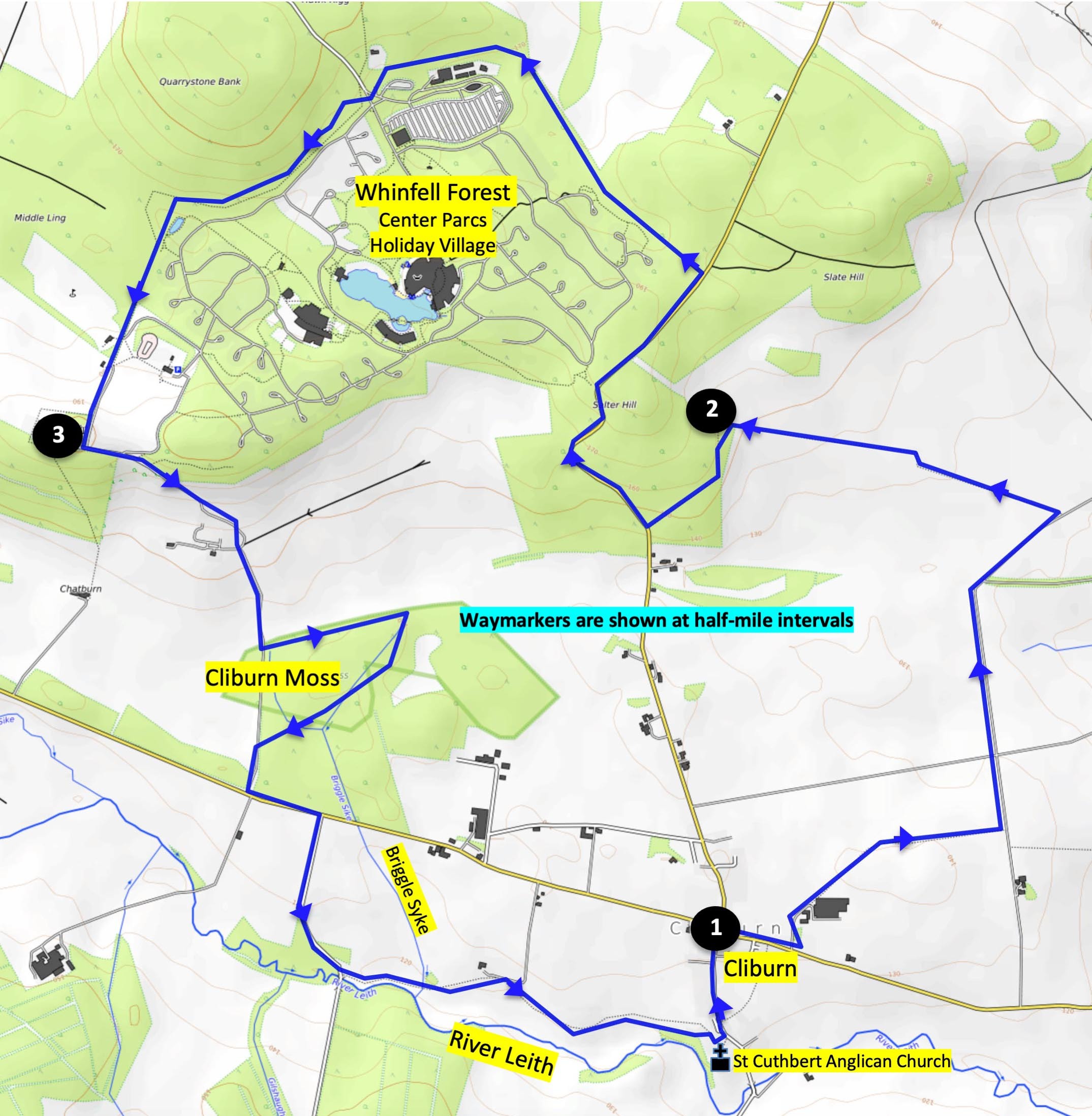
Cliburn route map
3. Turn left and descend the track past South Whinfell farm to the corner of Cliburn Moss Nature Reserve on the left. This is a wetland habitat produced by a hollow in the glacial valley. To visit the woodland, follow the footpath through the reserve in a clockwise direction, returning to the track further south. At the road turn left, walk beside the road for 300 yards and turn right at the junction signed Newby and Great Strickland. Immediately before Commonholme Bridge turn left onto the footpath signed Cliburn. Follow the footpath beside the river Leith, then crossing a footbridge over Briggle Sike. Keep to the left of a fence and continue towards the church. From here, it’s clear to see how the village got its name.
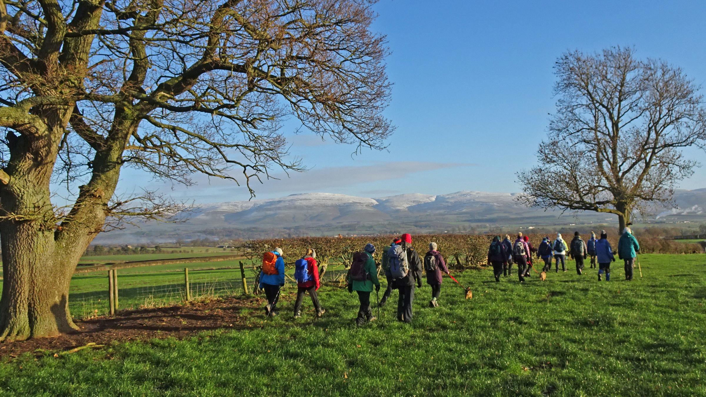
VIEWS: Ramblers walk from Cliburn will enjoy a stunning walk
Cliburn means ‘stream by the bank (or cliff)’: the stream is the river Leith and the church is at the top of the bank. Go through the farmyard and turn left onto the road to go up through the village to the crossroads where the walk began. Most of the village dates from the 18th and 19th Centuries, although there has probably been a settlement here for a thousand years. Cliburn Hall was built in the 14th Century as a pele tower by Robert De Cliburn (the lord of the manor) and is now a modernised farmhouse.
FACT FILE
Distance: 8 miles (13km); Ascent: 650 feet (200m); Time: 4 hours
Terrain: Grassy paths, stony tracks and quiet roads
Map: Ordnance survey OL5
Start: Cliburn crossroads, map ref. NY 587 249. Cliburn is 6 miles southeast of Penrith.


Comments: Our rules
We want our comments to be a lively and valuable part of our community - a place where readers can debate and engage with the most important local issues. The ability to comment on our stories is a privilege, not a right, however, and that privilege may be withdrawn if it is abused or misused.
Please report any comments that break our rules.
Read the rules here