

A COMMUNITY archaeology group has unearthed evidence of a long lost Roman road.
It had long been assumed there was once a road linking Roman Corbridge with its cavalry garrison to the well-established fort of Epiacum (known in recent times as Whitley Castle), near Alston.
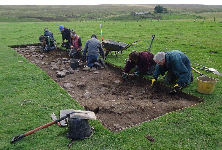
And two members of Altogether Archaeology have now unearthed a road that, while it doesn’t run all the way to Epiacum, does head south-west out of the village.
Martin Green and Greg Finch had long known of the rumoured road.
Greg said: “There’s often been speculation there was a road leading into Corbridge from the south-west.
“A book published in the 1730s contained a map with a line drawn from Corbridge to Whitley Castle/Epiacum and since then, people have claimed to find bits of Roman pottery and the like on nearby riverbanks.
“It was all highly speculative and it was dismissed, because there were no other signs.”
That was until the advent of LIDAR surveys around a decade ago.
The ‘light detection and ranging’ laser beams, usually emitted from a light aircraft, capture images of even the smallest lumps and bumps in the landscape in a way traditional aerial photographs can’t.
When the duo got hold of the LIDAR images of Hexhamshire and the Allen Valleys, they homed in on an area midway between Hexham and Allendale.
“It looked like a long, green line running straight across the land near Stublick chimney,” said Greg.
“We thought at first it would be a gas pipeline or some such, but when we went to have a look there was no sign of any utilities.
“However, we could see a faintly raised profile of something running across the ground and it had the width and profile of a Roman road.”
With the permission of the relevant landowners and farmers, Altogether Archaeology dug seven test pits in two different locations over a 10 day period – and rapidly unearthed an old road.
“It wasn’t a high grade road in the way of Dere Street, the Roman road leading from Corbridge to York,” he said.
“But nevertheless we’re pretty sure it’s a Roman road.
“It suddenly stops at Stublick and we’ll never really know why it didn’t go all the way to Epiacum, but it does seem plausible it went as far as it did because there was coal in Stublick.
“Also, when you consider the number of people living in Corbridge and the cavalry garrison there, they would have needed a huge amount of food, so this road might simply have been a supply road used to bring produce in from what must have been intensively farmed land for miles around.”
The full article on this Altogether Archaeology project appears in the new Hexham Historian publication, out now.


Comments: Our rules
We want our comments to be a lively and valuable part of our community - a place where readers can debate and engage with the most important local issues. The ability to comment on our stories is a privilege, not a right, however, and that privilege may be withdrawn if it is abused or misused.
Please report any comments that break our rules.
Read the rules here