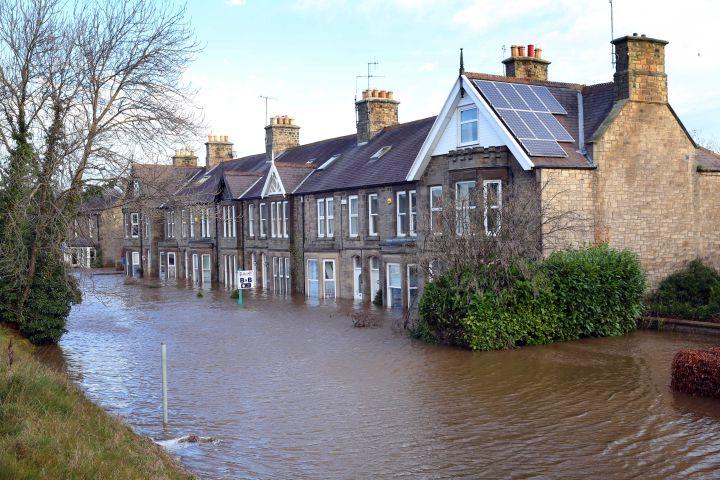
As displaced families and businesses continue to return to properties on Station Road and The Stanners following December’s devastating floods, both organisations have been working with the local community on flood prevention schemes.
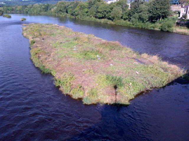
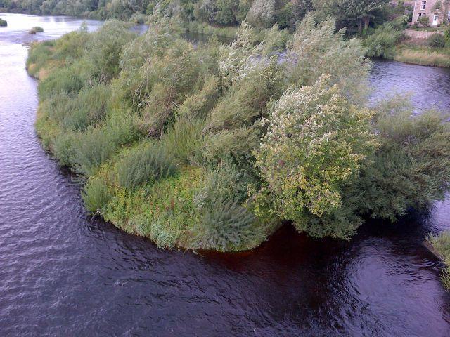
Members of the Environment Agency’s field operations team recently spent two weeks clearing vegetation from gravel islands in the Tyne near Corbridge Bridge after river modelling work suggested there was a minor increase in the flood risk due to the large amount of vegetation on them
The agency has also announced plans to skim the gravel down to below river level next year, in an effort to remove more roots and prevent the vegetation from growing again.
Chairman of Corbridge Parish Council, Coun. Maurice Hodgson, has welcomed the move.
“Work to remove the gravel down to water level is planned in for April, we’ve been told, and the work to remove the vegetation has made a big difference visually,” he told a recent meeting of Corbridge Parish Council.
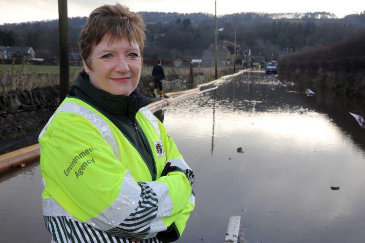
The Environment Agency and the county council continue to work with Corbridge Flood Action Group and keep members informed.
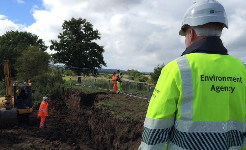
Removing the vegetation was part of an ongoing £3m flood recovery scheme by the agency, including repairs to flood banks in the village, which began in August.
Alan Cadas, Environment Agency operations manager for the North-East, said: “We plan to carry out work as part of our ongoing maintenance programme to remove any further vegetation that arises.
“This will, however, need to be monitored and the work planned as required. We’ll keep the community updated with our plans.”
At Devils Water, a 20-metre scour to the inside of the flood bank was repaired, along with 10 metres of erosion to the flood bank.
Work to install six-metre long sheet piles to stabilise the embankent further down from the cricket club is ongoing and expected to be completed next month.
Mr Cadas added: “The work will permanently repair flood defences to the standard of protection they provided before the winter flooding this past December.”
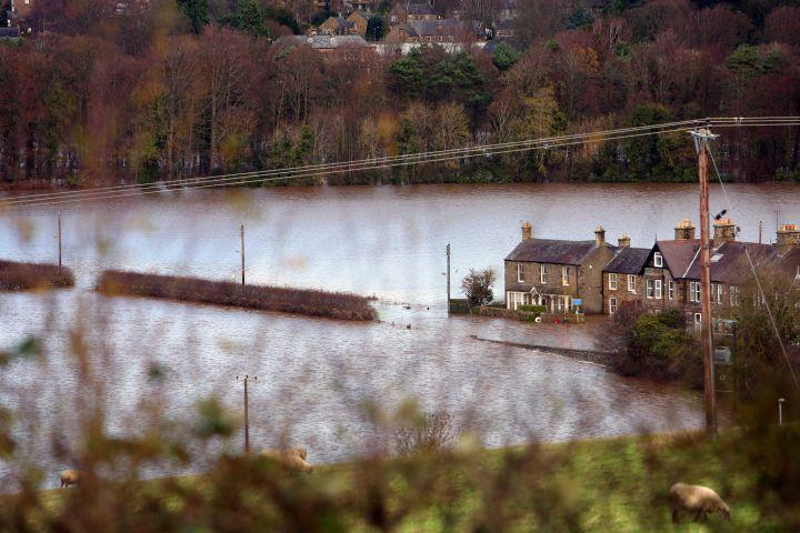
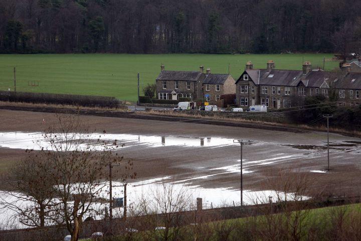
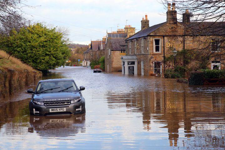
Tynedale was the area most affected by winter floods in the North-East, which saw record rainfall drop on to already saturated land, leading to some of the highest river levels since 1771.
In Corbridge, 55 homes and businesses fell victim to Storm Desmond, including four homes on the north side of the River Tyne at Well Bank.
Designs for a new drainage scheme for the whole Station Road area, on the south side of the river, are currently being drawn up by engineers from the county council.
It comes after blockages and damage to existing pipework was discovered after the deluge from Storm Desmond subsided.
The proposal includes a new combined outlet into the River Tyne through land owned by Tynedale Rugby Club.
A council spokesman said: “As part of the council’s £14.6m highway flood damage repair programme we are working on design options for a new drainage scheme in the Station Road area of Corbridge and have met flood group members and the parish council to update them on progress.
“As part of the new drainage we will be installing a new combined outlet into the river Tyne through land owned by Tynedale Rugby Club. We have also met with the club and aim to start work on the project towards the end of November. Council staff have also been trained and equipped with temporary pumps and pipework so that they can respond to any accumulations of surface water that may occur, day or night, whilst works are on-going to install the new drainage scheme.
“Contact details have also been provided to local residents so they can report any concerns they may have.”


Comments: Our rules
We want our comments to be a lively and valuable part of our community - a place where readers can debate and engage with the most important local issues. The ability to comment on our stories is a privilege, not a right, however, and that privilege may be withdrawn if it is abused or misused.
Please report any comments that break our rules.
Read the rules here